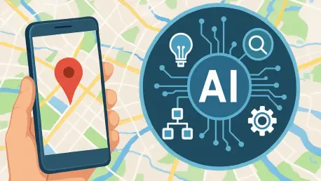

In an era where digital maps are no longer just about navigation but have become platforms for storytelling and innovation, Google Maps has introduced a transformative set of AI-powered tools that redefine how users and developers interact with geospatial content. Leveraging the sophisticated capabilities of Google’s Gemini models, this update brings forth features that simplify the creation of interactive, map-based projects, making them accessible to a broader audience. From small businesses to large enterprises, the potential to craft detailed city tours or real-time data dashboards in mere minutes marks a significant shift in the landscape of digital mapping. This development not only caters to technical developers but also invites non-coders to explore creative possibilities, turning complex ideas into tangible applications with ease. The focus on natural-language processing and low-code solutions underscores a growing trend toward democratizing technology, ensuring that geospatial tools are no longer confined to niche experts but are available for widespread, innovative use across various industries.
Transforming the Art of Map Design
Harnessing Natural Language for Instant Creations
The cornerstone of this update lies in the natural-language “builder agent,” a revolutionary tool that enables users to generate functional map prototypes through simple English prompts. Imagine a tourism board crafting a 3D walking tour with curated Street View scenes and accessible routes, all by describing their vision in plain text. This agent taps into Google Maps’ extensive data repository, logic, and user interface to produce projects like live weather overlays or directories for pet-friendly accommodations. Such capabilities drastically reduce the time and expertise needed to bring ideas to life, allowing users to prioritize creativity over technical hurdles. Developers can further refine these prototypes by exporting the code and integrating personal API keys, ensuring scalability through platforms like Firebase Studio. This seamless process empowers industries such as travel and hospitality to deliver engaging, map-centric experiences without the burden of intricate coding, marking a new era of accessibility in digital mapping.
Beyond the initial creation, the natural-language tool fosters an environment where iterative design becomes second nature for project creators. Businesses can test multiple concepts—such as a utility company prototyping an outage dashboard to categorize incidents and prioritize repairs—without committing extensive resources upfront. The ability to quickly pivot and adapt based on real-time feedback or changing needs is a game-changer, particularly for sectors where responsiveness is critical. Moreover, this feature bridges the gap between ideation and execution, enabling even those with minimal technical background to contribute meaningfully to map-based projects. By simplifying the first steps of development, Google Maps ensures that the focus remains on solving real-world problems, whether that’s enhancing customer engagement for a retailer or streamlining operational logistics for a delivery service. This democratization of technology signals a shift toward inclusive innovation, where the barriers to entry are lowered, and diverse perspectives can shape the future of geospatial applications.
Elevating Visual Identity with Custom Styling
Another standout feature is the styling assistant, which streamlines the process of creating branded cartography by allowing users to apply custom palettes, typography, and iconography to their maps. For businesses like retailers or event organizers, maintaining a consistent visual identity across digital platforms is crucial, and this tool eliminates the need for manual CSS or JSON adjustments. Available with additional customization options for a fee, it caters to professional branding needs by delivering polished, cohesive designs with minimal effort. Tourism boards, for instance, can now ensure their interactive maps reflect the aesthetic of their campaigns, enhancing user engagement through visually appealing interfaces. This focus on aesthetics without sacrificing functionality highlights how Google Maps is evolving to meet the dual demands of creativity and practicality, offering solutions that resonate with both end-users and corporate entities seeking to stand out in a crowded digital space.
The impact of the styling assistant extends beyond mere appearance, as it also supports strategic goals for businesses aiming to build trust and recognition through their digital presence. A retailer rolling out a store locator map with branded elements can create a memorable experience that aligns with their overall marketing efforts, fostering customer loyalty. Similarly, event organizers can use tailored map designs to guide attendees with clarity and flair, ensuring that every touchpoint reflects their unique identity. This tool’s user-friendly approach means that even teams without dedicated design staff can achieve professional results, saving time and resources while maintaining high standards. By integrating such customization into the Google Maps Platform, the update not only addresses a practical need but also empowers organizations to tell their stories visually, transforming static maps into dynamic tools for communication and connection in an increasingly visual world.
Advancing Precision and User Empowerment
Ensuring Reliable Data with Grounding Techniques
A critical advancement in this update is Grounding Lite, paired with the Model Context Protocol (MCP), designed to anchor AI models to real-world Google Maps data for enhanced accuracy. This technology minimizes the risk of AI-generated errors, often referred to as “hallucinations,” ensuring reliable outputs for location-based queries like finding the nearest grocery store or identifying neighborhoods within a specific transit time. For industries such as logistics, retail, and public safety, where precision in geospatial data is non-negotiable, this feature proves invaluable. It supports informed decision-making by providing situational awareness, whether it’s optimizing delivery routes or determining strategic store placements. By grounding AI responses in verified data, Google Maps addresses a common concern in AI applications, offering a foundation of trust that businesses can build upon when developing map-centric solutions for their operational needs.
Furthermore, the implementation of Grounding Lite and MCP reflects a broader commitment to improving the reliability of AI-driven tools in practical scenarios. Retailers can leverage this technology to integrate real-time inventory data with location insights, ensuring customers receive accurate information about product availability. Similarly, safety organizations can use precise geofencing to monitor and respond to incidents with confidence in the data’s integrity. This focus on accuracy not only enhances the user experience but also mitigates potential risks associated with incorrect AI outputs, which could otherwise lead to costly errors or misinformed strategies. As geospatial applications become more integral to business operations, the ability to trust the underlying data becomes a competitive advantage, positioning Google Maps as a leader in delivering dependable, AI-enhanced mapping solutions that cater to the nuanced demands of diverse sectors.
Simplifying Visualization Through Low-Code Solutions
The introduction of the Concept Maps component marks a significant step toward making complex mapping tools accessible to all users, regardless of technical expertise. This low-code visualization feature transforms text prompts into interactive outputs, such as ranked lists, dynamic maps, or 3D scenes, without requiring custom rendering code. A user searching for coffee shops with outdoor seating, for example, can receive both a detailed summary and a filterable map to explore options visually. This functionality lowers the barrier for non-developers, enabling small business owners or educators to create meaningful map-based content with ease. By prioritizing user intent over coding complexity, Google Maps ensures that innovative ideas can be visualized and refined quickly, fostering a more inclusive environment where creativity in geospatial storytelling is no longer limited to those with advanced programming skills.
Additionally, the low-code approach of Concept Maps empowers users to iterate on their ideas in real time, enhancing the decision-making process across various contexts. Real estate professionals, for instance, can generate interactive neighborhood scouts that combine data on schools, transit options, and price trends, providing clients with a comprehensive view without the need for specialized software. Media outlets can also benefit by producing news maps from reporters’ notes, turning raw information into engaging visual narratives for their audiences. This tool’s versatility lies in its ability to adapt to diverse needs, offering a bridge between conceptual ideas and practical applications. By embedding such accessible visualization options into the platform, Google Maps not only broadens its user base but also encourages experimentation, allowing individuals and organizations to explore geospatial data in ways that were previously out of reach due to technical constraints.
Building Support Systems and Addressing Challenges
Streamlining Development with Interactive Guidance
Among the supportive features of this update is the MCP server, which functions as a real-time coding copilot for developers working with Google Maps Platform documentation. By integrating AI assistants, it addresses implementation queries—such as required fields for Places Details—and flags potential issues like quota limits or billing impacts for high-volume tasks. Built on Gemini command-line extensions, this tool transforms static resources into a dynamic, context-aware guide, significantly cutting down the time needed to prototype new projects. Developers, especially those new to the platform, benefit from reduced support requests and a smoother onboarding process, enabling them to focus on crafting innovative solutions rather than navigating technical documentation. This interactive assistance underscores Google Maps’ commitment to empowering creators with the resources needed to succeed in building sophisticated map applications.
The value of the MCP server extends to fostering efficiency in project timelines, particularly for teams under pressure to deliver results quickly. For example, a developer working on a routing application for a mobility company can instantly clarify constraints around API usage, avoiding costly missteps before they occur. This proactive guidance also helps manage expectations around scalability, ensuring that projects remain viable as they grow in complexity or user base. By providing such a responsive support mechanism, Google Maps not only enhances the developer experience but also builds confidence in the platform’s reliability as a foundation for geospatial innovation. The ability to access real-time insights into potential challenges allows for more strategic planning, ensuring that technical limitations do not hinder the creative process but instead inform smarter, more sustainable development practices across industries.
Navigating Privacy and Governance in AI Innovation
As AI-driven tools become integral to map creation, concerns around privacy and governance take center stage, requiring careful consideration from developers and businesses alike. Projects utilizing these new features still rely on API keys and usage-based billing, necessitating strict controls over quotas, data residency, and access permissions. Grounding Lite’s MCP framework offers a promising solution by allowing sensitive data to remain within an organization’s environment while leveraging Google Maps’ robust resources. However, architects and developers must diligently verify data flow diagrams and replication policies to ensure compliance with regulations, especially for applications handling personal or proprietary information. Balancing the power of AI innovation with the responsibility of data security remains a critical challenge, one that demands ongoing vigilance to protect user trust and maintain the integrity of geospatial applications.
Moreover, the governance landscape surrounding AI tools extends beyond technical safeguards to include ethical considerations for how data is used and shared. Businesses in sectors like retail or logistics, where customer information is often integrated into map-based systems, must prioritize transparency in their data practices to avoid potential backlash. Establishing clear protocols for data handling, alongside leveraging features like Grounding Lite to minimize exposure, can help mitigate risks while maximizing the benefits of these advanced tools. Additionally, staying ahead of evolving regulatory frameworks will be essential as AI adoption grows, ensuring that innovation does not come at the expense of compliance. Google Maps has laid a foundation for addressing these concerns, but the onus remains on users to implement best practices, creating a secure environment where creativity and responsibility coexist in the development of transformative map projects.
Reflecting on a Milestone in Geospatial Technology
Looking back, the rollout of these AI-powered tools by Google Maps marked a pivotal moment in the evolution of digital mapping, setting a new standard for how geospatial content could be created and experienced. The natural-language builder agent, custom styling options, and low-code visualization features reshaped the accessibility of map-based projects, while innovations like Grounding Lite ensured data reliability for critical applications. Interactive developer support through the MCP server further streamlined workflows, addressing technical challenges with precision. Even as privacy and governance concerns persisted, the groundwork laid by these tools offered a balanced approach to innovation and security. Moving forward, businesses and developers are encouraged to explore practical next steps, such as integrating these features into existing systems for enhanced customer engagement or operational efficiency. Experimenting with pilot projects in sectors like retail or public safety could unlock untapped potential, while staying informed on data protection best practices will safeguard against risks. This milestone serves as an invitation to reimagine maps as dynamic tools for problem-solving, paving the way for future advancements in geospatial technology.