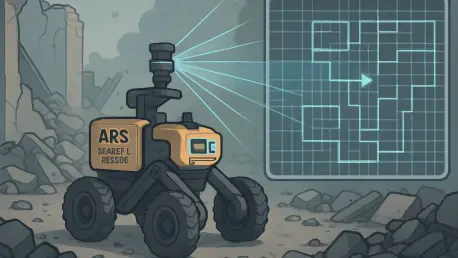

What happens when disaster strikes, and every second counts in finding survivors trapped under rubble? Picture a collapsed building after an earthquake, with rescue teams racing against time, unable to reach hazardous areas. Robots could be the key, but only if they can navigate chaotic, unpredictable environments with speed and precision. Enter a revolutionary breakthrough from MIT—a flexible mapping technology that equips search-and-rescue robots to chart treacherous terrains in near real-time. This innovation isn’t just a step forward; it’s a potential lifesaver, redefining how technology can serve humanity in moments of crisis.
The Urgent Need for Smarter Robots in Disasters
In the high-stakes world of disaster response, delays can mean the difference between life and death. Traditional robotic navigation systems often falter in dynamic settings like earthquake aftermaths or industrial accidents, struggling to map complex, shifting landscapes. With thousands of lives lost annually due to delayed rescues, the demand for faster, more reliable technology has never been clearer. MIT’s latest advancement addresses this critical gap, offering a solution that could transform emergency operations by enabling robots to move through danger zones with unprecedented accuracy.
The impact of such innovation extends beyond mere mechanics. When robots can swiftly create detailed 3D maps of disaster sites, they empower human responders to focus on strategy rather than risky exploration. This technology stands as a beacon of hope, promising to reduce response times and increase survival rates in scenarios where every moment is precious.
How MIT’s Mapping Tech Redefines Navigation
At the heart of this breakthrough lies a sophisticated yet practical system that blends artificial intelligence with time-tested computer vision techniques. Unlike older methods that bog down when processing vast areas, MIT’s approach breaks environments into smaller submaps, compiled from thousands of images. These segments are then seamlessly stitched into comprehensive 3D reconstructions, allowing robots to understand their surroundings with startling detail.
A standout feature is the real-time localization capability, powered by simultaneous localization and mapping (SLAM). This means a robot can track its exact position while building its map, even in chaotic settings, with tests showing an accuracy of less than 5 centimeters. By integrating machine learning with classical methods, the system also corrects visual distortions, ensuring precision that could pinpoint a survivor’s location amidst debris.
What makes this even more remarkable is its accessibility. Requiring only standard cameras—similar to those on everyday cell phones—this technology eliminates the need for expensive, specialized gear. It’s a design that prioritizes practicality, ready to be deployed where it’s needed most without cumbersome setup or calibration.
Behind the Innovation: Insights from the MIT Team
The minds driving this project shared their passion and challenges at a prominent conference on neural information processing systems. Lead researcher Dominic Maggio emphasized the limitations they encountered with pure AI models, noting, “Disaster zones are too vast for standard machine learning to keep up.” This realization pushed the team, including postdoc Hyungtae Lim and senior author Luca Carlone, to draw inspiration from 1980s computer vision research, crafting a flexible alignment method that tackles large-scale mapping.
Their published findings on a preprint server reveal a relentless focus on simplicity. Maggio highlighted how the system’s reliance on basic hardware democratizes its use, stating, “Anyone with a standard camera can leverage this tech.” Tests at locations like the MIT Chapel underscored its potential, achieving near-instant 3D maps with minimal error, a testament to human ingenuity meeting urgent need.
The team’s vision goes beyond the lab. They aim to refine reliability for the most complex disaster scenes, ensuring that this tool isn’t just a prototype but a lifeline ready for real-world crises. Their dedication paints a picture of technology shaped by a deep commitment to saving lives.
Real-World Impact: Saving Lives with Precision
Imagine a mine collapse where workers are trapped in pitch-black, unstable tunnels. Robots equipped with MIT’s mapping system could dart through, creating detailed layouts in minutes to guide rescue efforts. This isn’t science fiction—it’s the tangible promise of a system that processes visual data at lightning speed, identifying safe paths and potential hazards with pinpoint accuracy.
The implications ripple outward. In urban disasters, where collapsed structures create mazes of danger, such robots could mean faster evacuations and fewer casualties. Data from controlled tests suggest a dramatic reduction in mapping time compared to traditional systems, shaving off critical minutes that could save lives. This technology positions itself as a game-changer, bridging the gap between human limitations and the urgent demands of emergency response.
Moreover, its scalability hints at broader applications. Beyond rescue missions, industries like warehousing could use it for efficient navigation, while virtual reality developers might harness it for immersive spatial mapping. The versatility of this innovation signals a shift in how robots interact with the world, opening doors to safer, smarter operations across sectors.
Deploying the Future: Steps to Bring Tech to the Field
Turning this cutting-edge system into a field-ready solution requires strategic planning. First, robots must be outfitted with standard onboard cameras, ensuring no additional costs for specialized equipment. This keeps deployment accessible for organizations with limited budgets, a crucial factor in widespread adoption.
Next, training protocols should focus on incremental submap processing, enabling real-time updates as robots navigate live disaster zones. Starting with controlled simulations before moving to full-scale disaster scenarios will help iron out any kinks, guaranteeing reliability when stakes are high. Additionally, collaboration with emergency response agencies can tailor the tech to specific needs, enhancing its effectiveness in varied contexts.
Looking ahead, expanding testing from 2025 to 2027 across diverse environments will solidify its readiness. Exploring secondary uses, such as in industrial automation, could also drive innovation, ensuring this system evolves to meet emerging challenges. These steps lay a foundation for a tool that doesn’t just promise change but delivers it, reshaping how crises are handled.
In reflecting on this journey, the efforts of MIT’s team stand as a powerful reminder of technology’s potential to serve humanity. Their work carves a path for actionable progress, ensuring that robots become true allies in disaster response. As challenges persist, the focus remains on refining and scaling this innovation, with the hope that every advancement brings society closer to a safer, more resilient world.