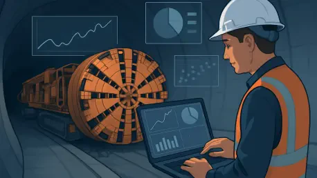

Modern tunneling projects represent some of the most complex and ambitious feats of civil engineering, burrowing deep beneath bustling cities or through sensitive natural environments where the margin for error is virtually nonexistent. These high-stakes undertakings are defined by immense geological uncertainty and a constant barrage of data from countless sources, including borehole logs, laboratory tests, and real-time sensor readings. The traditional, manual methods of collating and interpreting this information are proving increasingly inadequate, creating data silos and inefficiencies that obscure a clear understanding of subsurface risks. This fragmented approach can jeopardize project timelines, escalate costs, and, most critically, compromise the safety of both workers and the public. A new paradigm, centered on unified data, is essential to navigate these challenges successfully.
The Perils of Fragmented Subsurface Intelligence
The fundamental difficulty in any tunneling project stems from an inherent information deficit, where engineers must extrapolate ground conditions from a limited number of discrete data points, such as boreholes. This process generates a massive volume of information from disparate sources, including digitized field records, complex geological profiles, and extensive laboratory test results. When this data is managed in isolated spreadsheets or separate software systems, it creates a disconnected and often contradictory view of the subsurface. This fragmentation prevents the formation of a holistic, reliable understanding of the project environment, forcing critical decisions to be based on an incomplete and potentially flawed picture of reality. This lack of a unified perspective introduces significant uncertainty at every stage of the project, from initial design to final construction, making it difficult to anticipate and mitigate potential hazards effectively.
This reliance on disconnected systems and manual data entry creates severe operational bottlenecks that ripple through the entire project lifecycle. Engineers can find themselves spending an inordinate amount of time on repetitive, low-value tasks like transcribing data and reformatting files, which detracts from their core responsibility of conducting high-level risk investigations and optimizing engineering designs. This manual approach is not only incredibly time-consuming but is also highly susceptible to human error. A single misplaced decimal or incorrect data entry can have cascading negative effects, compromising the accuracy of geological models and subsequent engineering analyses. The consequences of such errors can be profound, leading to flawed assumptions about ground stability, water ingress, or settlement, ultimately amplifying project risk and threatening the structural integrity of the tunnel and surrounding infrastructure.
Building a Cohesive Digital Ground Model
The most effective strategy to combat data fragmentation is the creation of a unified, dynamic 3D ground model that functions as the project’s single source of truth. Advanced software solutions are now capable of integrating vast amounts of information from various geological and geotechnical sources into a single, cohesive digital environment. This automation eliminates the laborious and error-prone task of manual data consolidation, thereby freeing engineers to dedicate their expertise to interpretation, analysis, and risk mitigation. The resulting 3D model provides a clear, intuitive, and interactive visualization of the complex relationship between the proposed tunnel alignment and the surrounding geology. This approach was exemplified in the second phase of Singapore’s Cross Island Line (CRL2), a project contending with highly variable ground conditions, from soft marine clay to hard granite, all while navigating a dense urban landscape and environmentally sensitive areas.
On the CRL2 project, the comprehensive 3D ground model became the central hub for planning, design, and communication, transforming how the multidisciplinary team approached the formidable challenges. This powerful visual tool enabled all stakeholders, from geologists and engineers to clients and contractors, to develop a shared and unambiguous understanding of the subsurface conditions. The model proved instrumental in identifying critical gaps in the existing geological data, which allowed for targeted site investigations to reduce uncertainty. It also facilitated the optimization of the tunnel design to balance construction efficiency with long-term operational effectiveness. Furthermore, the model was used to create clear visualizations that effectively communicated potential construction risks to all parties, ensuring a collaborative approach to mitigation. This data-driven strategy also yielded significant efficiency gains, proving to be approximately 90% faster than traditional methods for producing ground level and rock surface contours, which led to more accurate settlement predictions and a refined structural impact assessment on nearby buildings.
Validating Designs with Advanced Simulation
A unified data model serves as more than just a powerful visualization tool; it is the essential foundation for conducting advanced engineering analysis and validating designs against complex, real-world conditions. By feeding the integrated geological data from the 3D model into sophisticated Finite Element Modeling (FEM) software, engineers can run detailed simulations of complex soil-structure interactions. This allows them to accurately predict how the ground will deform and behave during and after construction, providing invaluable insights into potential settlement, stress distribution, and overall stability. This simulation capability is critical for validating proposed construction methods and ensuring the safety of both the new tunnel and adjacent infrastructure, particularly in high-risk scenarios where conventional analysis may not capture the full spectrum of potential behaviors. This proactive approach allows teams to test and refine their strategies in a digital environment before any ground is broken.
The extension of Madrid’s Metro Line 5 serves as a compelling illustration of this data-driven validation process. The project involved the monumental challenge of constructing a new tunnel with a clearance of only three meters between an existing, operational metro line and a major motorway embankment. The extremely tight tolerances and high risk initially prompted consideration of a slow and costly excavation technique to ensure safety. However, by leveraging PLAXIS 3D, the engineering team developed a highly sophisticated soil-structure interaction model that included over 400 distinct construction phases and all surrounding structures. This complex simulation allowed them to prove that a combination of more conventional and cost-effective excavation methods could be employed safely. The analysis definitively demonstrated that excavating the tunnel face in shorter, 1.25-meter-long segments would effectively minimize ground movement, thereby protecting the adjacent infrastructure. This robust, data-driven validation provided the project team with the confidence to proceed with a safer, faster, and more economical construction plan.
An Evolved Framework for Collaboration
The successful de-risking of complex tunneling projects ultimately required the unification of not just the data, but also the diverse, multidisciplinary teams that depended on it. The implementation of shared digital platforms, such as Bentley’s ProjectWise, became crucial for ensuring that all parties were consistently working from the most current and accurate information available. On a project as multifaceted as Singapore’s CRL2, this collaborative environment seamlessly connected over 20 different teams, breaking down traditional information silos and streamlining communication. This integration ensured that the critical insights derived from the 3D ground model and advanced simulations were effectively disseminated and incorporated into the overarching planning and execution processes, fostering a truly holistic approach to project management.
By operating from a common operational picture built upon a foundation of unified and reliable data, decision-making across all project disciplines became more agile, collaborative, and profoundly informed. This integrated digital workflow represented a fundamental shift in how teams identified, assessed, and mitigated the immense geotechnical risks inherent in modern tunneling. The adoption of these systems moved project teams away from a reactive, problem-solving posture and empowered them with a proactive capability to anticipate and manage challenges with greater precision. This evolution in methodology allowed for the delivery of critical underground infrastructure that was not only safer and more efficient but also demonstrably more sustainable, establishing a new and elevated benchmark for the future of subterranean construction.