
Standing on a windswept coastline, the sight of a massive cargo ship appearing on the distant horizon often sparks a series of questions that remain unanswered without specialized equipment or nautical expertise. For decades, the hobby of ship spotting relied on high-powered binoculars and the manual cross-referencing of thick registers or separate, static online databases. Today, augmented reality has fundamentally bridged the cognitive gap between physical observation and digital information, effectively turning every smartphone into a sophisticated maritime identification tool. By overlaying dynamic vessel names, registration flags, and precise distances directly onto a live camera feed, this technology acts as a real-time name tag generator for the high seas. This immediate context transforms a simple silhouette into a detailed profile, allowing observers to understand exactly what they are seeing without looking away from the water. The integration of such immersive data layers provides a level of instant gratification that was previously impossible, setting a new standard for how individuals interact with the maritime environment.
The Technical Infrastructure: Merging Streams
Data Synthesis: The Power of AIS Integration
The technical backbone of this digital transformation is the sophisticated synthesis of the Automatic Identification System with modern mobile hardware and cloud-based processing. Ships are required to broadcast a constant stream of identity, position, and course data, which augmented reality applications capture and process alongside a phone’s internal GPS and orientation sensors. By calculating the exact bearing of nearby vessels, the software can pin digital labels to specific physical objects, ensuring that data points stay anchored to the ships even as the viewer pans their camera across the moving water. This process requires incredible precision, as even a minor calibration error in the device’s compass could lead to labels drifting away from the hulls they are meant to identify. Developers have focused on minimizing this latency by implementing predictive algorithms that forecast a ship’s position based on its current velocity, maintaining a seamless visual connection even during rapid movement or signal fluctuations.
Sensor Coordination: Spatial Awareness in Real Time
Modern devices leverage a combination of magnetometers, accelerometers, and gyroscopes to maintain the alignment between the digital overlay and the physical world. This tri-sensor approach allows the software to compensate for the natural tremors of a user’s hand and the swaying motion common on coastal piers or boat decks. Furthermore, high-accuracy GPS units provide the necessary location data to calculate the relative distance between the observer and the vessel, which is essential for scaling the digital labels correctly. When a ship is several miles away, the font size and icon transparency adjust automatically to ensure the horizon remains visible, whereas closer vessels receive more prominent and detailed markers. This environmental awareness ensures that the augmented experience feels like a natural extension of the user’s vision rather than a distracting or disconnected overlay. By harmonizing these internal sensors with external data streams, the technology provides a stable and reliable platform for real-time maritime discovery and navigational safety.
User Interface: Streamlining the Digital Overlay
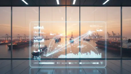
To ensure a smooth user experience in busy maritime hubs, these systems utilize advanced interface management techniques to prevent visual clutter from overwhelming the observer. In major global ports where dozens of vessels might be anchored or in transit simultaneously, the technology must intelligently group ships into tappable clusters to avoid overlapping text and chaotic screen displays. Sophisticated filtering options allow users to toggle specific vessel types, such as tankers or cruise ships, focusing their attention on what matters most in a crowded waterway. Additionally, integrated directional guides and virtual radar dials assist users in locating vessels that are currently outside their immediate field of vision, making the vastness of the ocean feel organized and navigable. This spatial organization does more than just identify ships; it provides a comprehensive view of the entire maritime ecosystem, allowing for a better understanding of traffic patterns and harbor operations. By refining how data is presented, the software transforms a deluge of information into a clear visual map.
Impacts on the Maritime Community
Public Engagement: Expanding Coastal Knowledge
One of the most significant impacts of maritime augmented reality is the democratization of specialized knowledge for the general public and casual enthusiasts alike. It provides immediate gratification by turning a casual inquiry into a detailed answer within seconds, removing the need for a deep understanding of complex nautical charts or radio signals. This transition from abstract data to an intuitive visual format allows anyone, regardless of their professional background, to engage with the maritime environment in a meaningful and educational way. By lowering the barrier to entry, the technology has sparked a renewed interest in maritime history and logistics among younger generations who expect information to be accessible and interactive. Coastal residents now find themselves more connected to the rhythms of their local ports, recognizing recurring vessels and understanding the vital role that global trade plays in their daily lives. This increased visibility fosters a sense of stewardship and curiosity, as the shipping world becomes a visible part of the local landscape.
Social Connectivity: Sharing the Maritime Narrative
Beyond the simple act of identification, the technology adds a profound narrative layer to coastal life, turning a static view into a dynamic and living story. By revealing a ship’s port of origin, its final destination, and its current journey across the globe, augmented reality enriches the observer’s surroundings and makes the experience inherently shareable. Capturing and posting these augmented views on digital platforms allows users to turn a solitary moment of discovery into a social interaction, fostering a broader community of observers and curious onlookers worldwide. This shared experience often leads to collaborative learning, where seasoned spotters provide context on a vessel’s unique history or construction to those just beginning their journey. The ability to document a rare vessel sighting with an informative overlay provides a sense of accomplishment and contributes to a global database of maritime activity recorded by citizen scientists. As people share these insights, the culture of ship spotting evolves from a niche hobby into a mainstream activity that emphasizes global interconnectedness.
Strategic Awareness: Limitations and Future Readiness
As the technology matured, the maritime community recognized that the effectiveness of augmented reality remained tied to specific technical realities and equipment constraints. The system relied entirely on active transponder broadcasts, meaning that vessels with inactive equipment or those below certain size requirements did not appear in the digital overlay. Furthermore, the accuracy of labels depended on the health of a mobile device’s internal sensors, reminding users that while the technology was transformative, it functioned as a complement to traditional observation. Stakeholders prioritized the development of offline data caching to ensure functionality in remote coastal areas where cellular signals were weak or non-existent. These improvements ensured that observers maintained situational awareness even in challenging environments. Moving forward, the focus shifted toward integrating environmental data such as tide levels and weather patterns into the visual field to provide a more holistic view of the ocean. By embracing these advancements, enthusiasts and professionals alike secured a more detailed and interactive understanding of the maritime world than ever before.